 Image 1 of 1
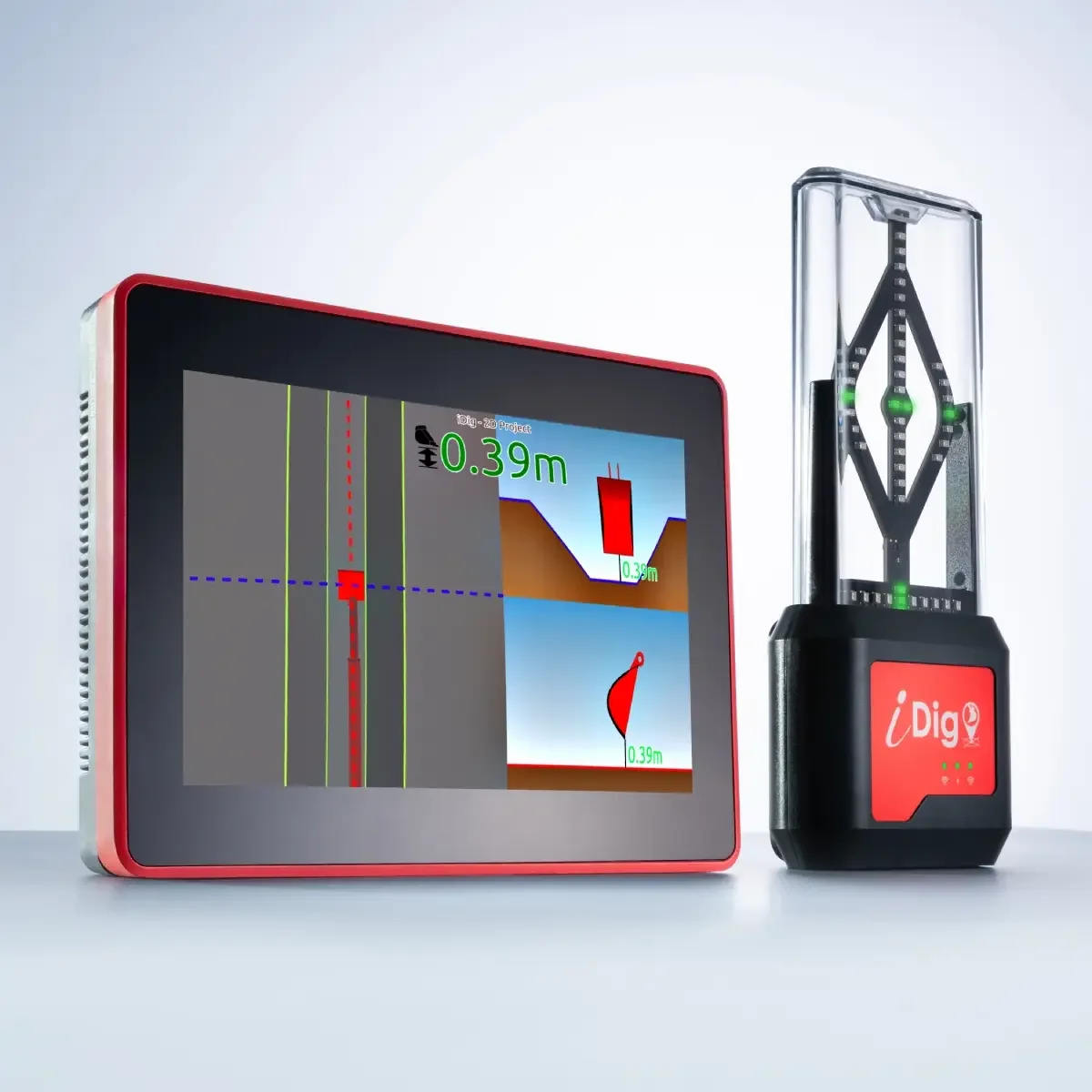
CONNECT 2D PROJECT Details - iDig SystemThe idig Connect 2D Project is a excavator grade control system that allows for precise operation and measurement on construction and landscaping projects without relying on a surveyor or traditional stakes. It's a "lite" version of the full 3D software, suitable for small to medium-sized contractors, offering features like slope guidance, depth measurement, site surveying, and data capture from the excavator cab using solar-powered, wireless sensors. The system can integrate with a GNSS (GPS) receiver for high-precision positioning and is designed for easy self-installation and transfer between different excavators.
Key Features & Capabilities
Excavator Grade Control:
The system guides the excavator operator to achieve a precise finish grade by monitoring the bucket's position relative to a laser or a known point.
GNSS Integration:
It can be paired with a GNSS (SPOTMAN) receiver for precise positioning without traditional stakes.
Site Surveying & Data Capture:
Operators can survey the terrain, create projects in the field, capture points and lines for as-built data, and measure volumes.
Easy Self-Installation:
The system is designed for quick, plug-and-play self-installation in about an hour, with wireless and solar-charged sensors.
User-Friendly Interface:
It features a dual-core touchscreen control box with intuitive software for operators.
Versatility:
The system is compatible with all excavator brands and sizes and supports various applications, including earthworks, foundations, and landscaping.